I was very excited to see “hilly or trail run” on my training schedule this week! We are very close to the Walnut Creek/Shell Ridge Open Spaces, which provide endless trails, lots of elevation changes and gorgeous scenery! For about 8-9 months a year the hills are California dead, um…I mean gold! But right now we are in the middle of the green season, and it is spectacular this year thanks to El Niño (sadly no photos as I don’t run with a camera – but enjoy the sampling of dead – slightly dead below)!
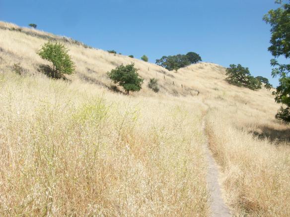
The climb to the Open Space – in shades of California Gold!
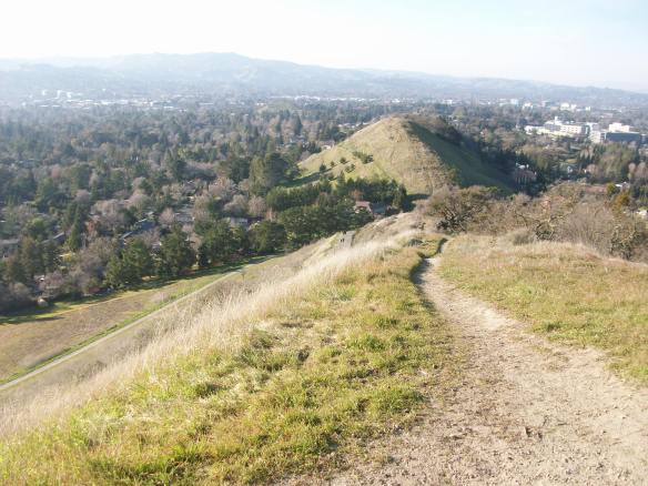
Atop the ridge, a few years ago with a hit of green (is now lovely and lush!)
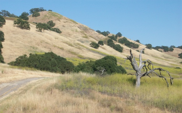
May in the Open Space – mostly dead with hints of green.
See, scenery worth running up hills for, right?! This week’s 8 miler seemed like the perfect excuse to reacquaint myself with the old trails! I mapped out my route the night before, carefully planning a mix of known trails and some new extensions to make up the distance. I studied the elevation to make sure it was challenging but not stupid, and I saved the route so that my husband could find my broken little body if it all went poorly!
I headed out just before 4pm, giving myself plenty of time before the sun set. It started out beautifully with my long, gradual up hill and exploring some new trails. I passed some cows grazing in a field, saw chickens and goats at a historic ranch and found a sign with a map that verified that I was about half way done, and exactly where I needed to be!!
And then it all went wrong.
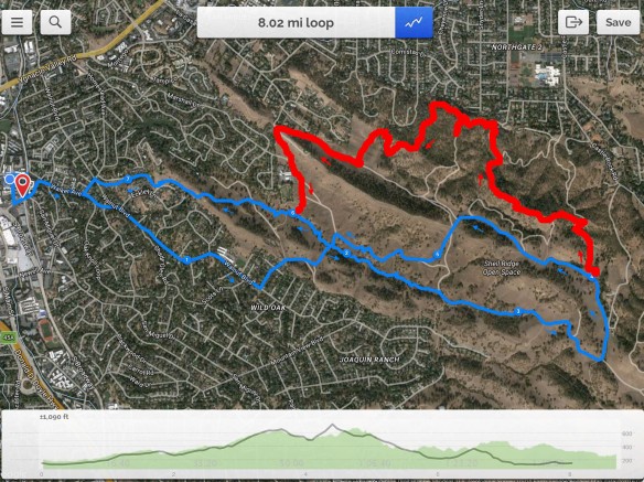
As you can see, there is some discord between the intended route (blue, 8.02 mile line) and the ahem, detour (red line). And a slight variation in the actual elevation (green shaded area) and the intended elevation (grey line). The final third is particularly more uppy-downy than planned!
It was that critical moment, that fork in the road…that time in your life when you realise you have an important choice and you have to pick a path. I choose poorly. Instead of turning left and finishing the top loop of the figure eight route, I turned right. As you can see below, it was a mistake both distance and elevation wise.
I didn’t mind exploring a bit, but I realised that I didn’t really know how to set things right. In an attempt to find higher ground to get a better sense of where I was, I took a steep trail up. I had a spectacular view of San Francisco, the Bay, and the Marin Headlands but I couldn’t actually see Walnut Creek, or the trails I was standing over due to tree and hill coverage. Crap.
I continued in the general direction of San Francisco (when in doubt, go west) and had a vague idea of where I was. But it was starting to get overcast, and the sun started to lower on the horizon. I hadn’t seen anyone else for about 45 minutes and couldn’t find a map. I finally saw a guy coming towards me on a bike around mile 6.5 and swallowed my pride and declared “I’m completely lost – how do I get downtown?”. He gave me some directions that made some sense, and then just said “Do you want me to go with you?”. I was so grateful, especially because it meant he would be turning around and going back from where he came! He then cycled in front of me for the next mile and a half until we hit a point that I could get home from! I am so fortunate, and will forever be grateful for the random act of kindness from this total stranger!
At the end of the day I ran about 8.5 miles before hitting the steep climb out of the Open Space. I stopped my gps watch and walked up (I was pretty knackered at this point) and then jogged the remaining mile home. So my lovely 8 mile figure eight route turned into a 9.5 mile adventure! Alls well that ends well, but next time I think I might bring a map!
